Campus Facilities
About the Lab
The Environmental Mineralogy Imaging Lab offers access to imaging and analytical characterization technologies to WSU faculty, staff, and student researchers. This facility is also available to researchers from other universities, foundations, and industry.
In addition to instrument access, EMI personnel offer advice, hands-on training, education, and research collaboration. Our goal is to promote, enable, and encourage cutting-edge education and research using the lab’s instrumentation.
Instrumentation
The EMI lab contains a Thermo Scientific Phenom Pharos desktop Scanning Electron Microscope (SEM) with a Field Emission Gun (FEG). The instrument is equipped with BSE, SE, and EDS detectors allowing for morphological, compositional, and chemical analysis of materials. This SEM has a maximum magnification of 1,000,000x with a resolution of 2.5 nm (SE), and can operate in a variety of accelerating voltages and vacuum modes. Analytical capabilities include elemental mapping & line scanning as well as 3-D roughness reconstruction.
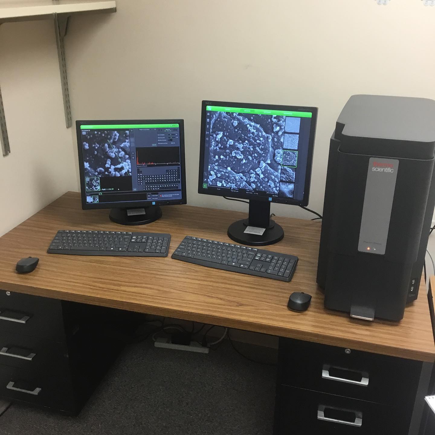
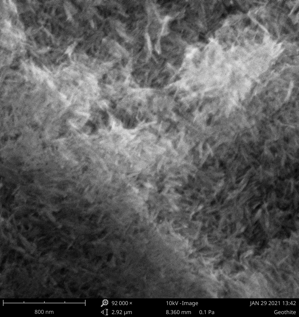
- Image of Goethite nanoparticles synthesized by Derby High School students
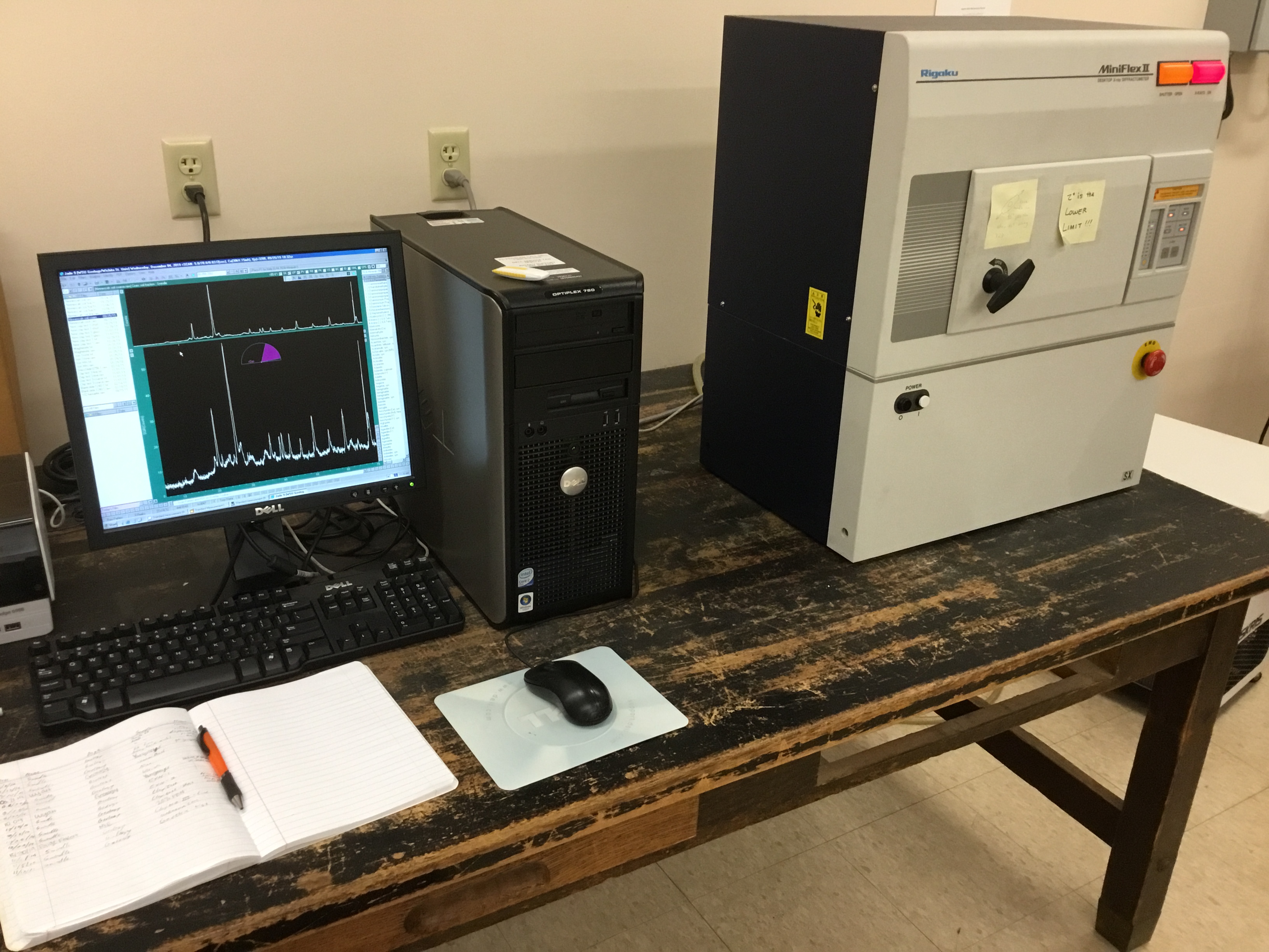
The Rigaku Mini Flex II X-ray diffractometer can determine: crystalline phase identification, percent crystallinity, crystallite size, and lattice parameter refinement. For data analysis the MDI Jade software is interfaced with databases from the International Centre for Diffraction Data.
The EMI lab is primarily equipped for preparation of geologic materials such as bulk rock, sediment, soil and clay samples, with tools including a puck mill, centrifuge, ultrasonic probe, desiccators, drying oven, heating water bath, and vacuum filtration. Additionally, the lab has a Cressington 108 Sputter coater with a Au target for non-conductive SEM samples.
Schedule and instrument scheduling
The regular hours of the EMI will be from 8:00 a.m. to 5:00 p.m. Monday through Friday.
Instrument scheduling: Qualified users that have undergone training and demonstrated proficiency will be allowed unsupervised use of EMI equipment. All other use will be supervised by EMI personnel.
Rates
Prices effective April 1st 2021 and are subject to change. Please contact personnel with any questions or concerns.
All users must supply all disposable materials needed for their work; we endeavor to keep common supplies at-hand for use.
Charges: Users are charged for the SEM at an hourly rate. This rate includes use of any detectors (BSE, SE, EDS) and software (elemental mapping, 3-D roughness) required by the user. Users of the XRD are charged on a per-scan basis and this charge includes use of the Jade software and ICDD database.
|
Charges for use |
Internal |
External |
|||
|
Scanning Electron Microscopy |
|||||
|
Phenom Pharos |
$46.00/hr |
$75.00/hr |
|||
|
X-Ray Diffractometer |
|||||
|
Mini Flex II |
$21.00/scan |
$35.00/scan |
|||
What are the reasons to justify these costs?
- Field Emission Gun and vacuum system – The FEG source for the SEM has a lifespan of ~10,000 hours while the vacuum system requires periodic pump maintenance. The annual service contract for this maintenance is approximately $16,000.
- X-ray tube – The Cu X-ray source in the XRD degrades over time. The expected lifetime is around 5 years and the cost of replacement tubes is approximately $4,000.
- Materials and supplies – Copper tape, aluminum stubs, carbon tape, weigh boats, methanol, safety equipment (gloves, eye protection), replacement glassware, computers and paper, sputter coater targets etc. that are utilized by most lab users must be replaced.
- Database renewal – The ICDD PDF-2 Scholar package, providing the latest database access, support, and updates through spring of 2024. This subscription requires renewal at a cost of approximately $6,000.
Lab is equipped with petrographic optical microscopes and digital imaging hardward for rock identification
Lab is equipped for a wide range of low to moderate temperature geochemical experiments, particle synthesis, and field sample processing. Laboratory equipment includes: pH meters, stir plates, a heated water bath, microbalances, drying ovens, and a shaker table. The Thermo Scientific Genesys 10S scanning UV-visible spectrophotometer also for quantification of a wide variety of aqueous constituents. Low-concentration element work is facilitated by a distilled-deionized water system.
The Sedimentary Basin Analysis and Modeling Lab includes wide range of field equipment and computers for developing and improving geologic techniques and applications in the search for resources in sedimentary basins. Lab research focus includes characterization and modeling of subsurface and outcrop analogs, sequence and seismic stratigraphy, microbial carbonate reservoirs, and handling uncertainty in geologic data.
The Geospatial and Geodynamics Lab at Geology Department at Wichita State University have the following hardware and software:
- Four high-performance workstations and other high processing computers
- One 42" plotter
- One-color printer
- One black and white printer
- One 12" scanner
- OASIS Montaj-Geosoft for subsurface lithospheric structure modeling and analysis
- 2D and 3D GEM SYS forward modeling inversion module for Gravity, magnetics and electrical resistivity potential data
- L3HARRIS Geospatial: Environment for Visualizing Images (ENVI) 5.5.3 software for digital image processing of remotely sensing data including:
Optical imagery pixel tracking module
Multi-Spectral and hyperspectral mapping module
LIDAR: DSM cloud points module
SARscape: Radar Interferometry module (InSAR)
Deep Learning module for fast and accurate automotive analytics results
Photogrammetry module: DSM cloud points generation from stereo images
- ESRI ArcGIS 10.7 and ArcGIS pro 2.4 software to produce vector-based map production, spatial analysis, Geospatial database, all geoprocessing module extension, web map sharing and to generate story map
- SNAP Sentinel-1 toolbox (S1TBX), Sentinel-2 toolbox (S2TBX), Sentinel-3 toolbox (S3TBX)
- GoogleEarth Pro
- Adobe Web Premium
- Microsoft Office and Outlook
Multiple labs with computing resources for energy and mineral exploration, GIS and geospatial anaylsis, and hydrogeologic simulations. Software includes:
RESOURCE EXPLORATION
- IHS Kingdom Suite
- IHS Petra
- LMKR Geographix
- Schlumberger Petrel
GIS and GEOSPATIAL ANALYSIS
- ArcGIS
- QGIS/QGIS Field
HYDROGEOLOGIC SIMULATION
- TBA
The department houses a wide variety of field equipment for field mapping, measurements, and sample collection.
The department also has a field portable handheld SciAps XRF for in-field elemental analysis. The unit is calibrated with 37 standard elements including all measurable pathfinders except REE’s.
The department has retained a large collection of rock, mineral, and fossil samples since its founding in 1926. These resources are vital for teaching and research by our faculty and students.
Off-Campus Field Sites
The Hydrogeologic Research and Teaching Field Site was made possible through generous donations from GSI Engineering (http://gsinetwork.com/) and the Kansas Geological Foundation. Located on an ~10 acre area of the larger Ninnescah Reserve (https://www.wichita.edu/academics/fairmount_las/bioscience/fieldStation/MapNinnescah.php), the Site consists of nine 2" groundwater observation wells (20-25' total depth) and one 6" pumping well (20' total depth) screened in alluvial sands along the Ninnescah River.
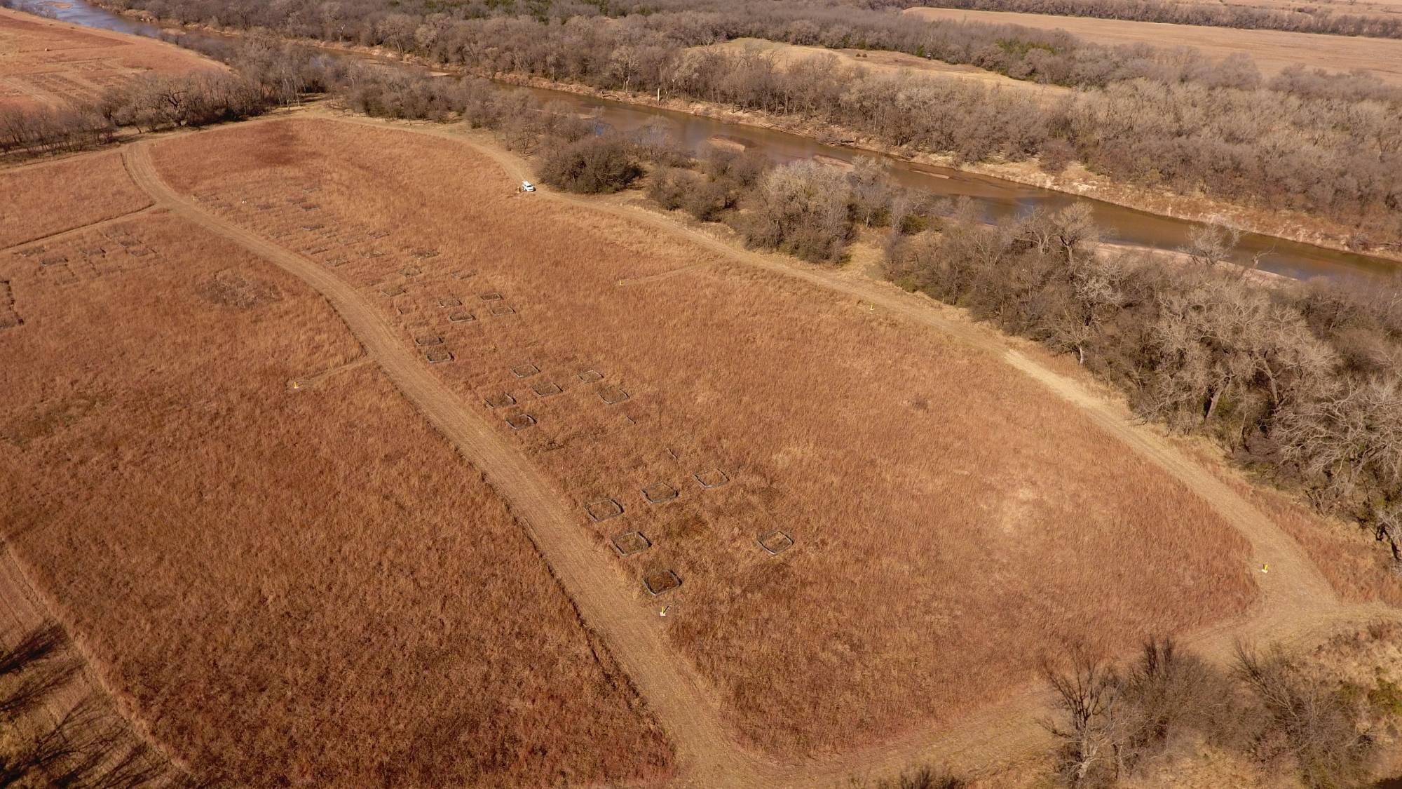
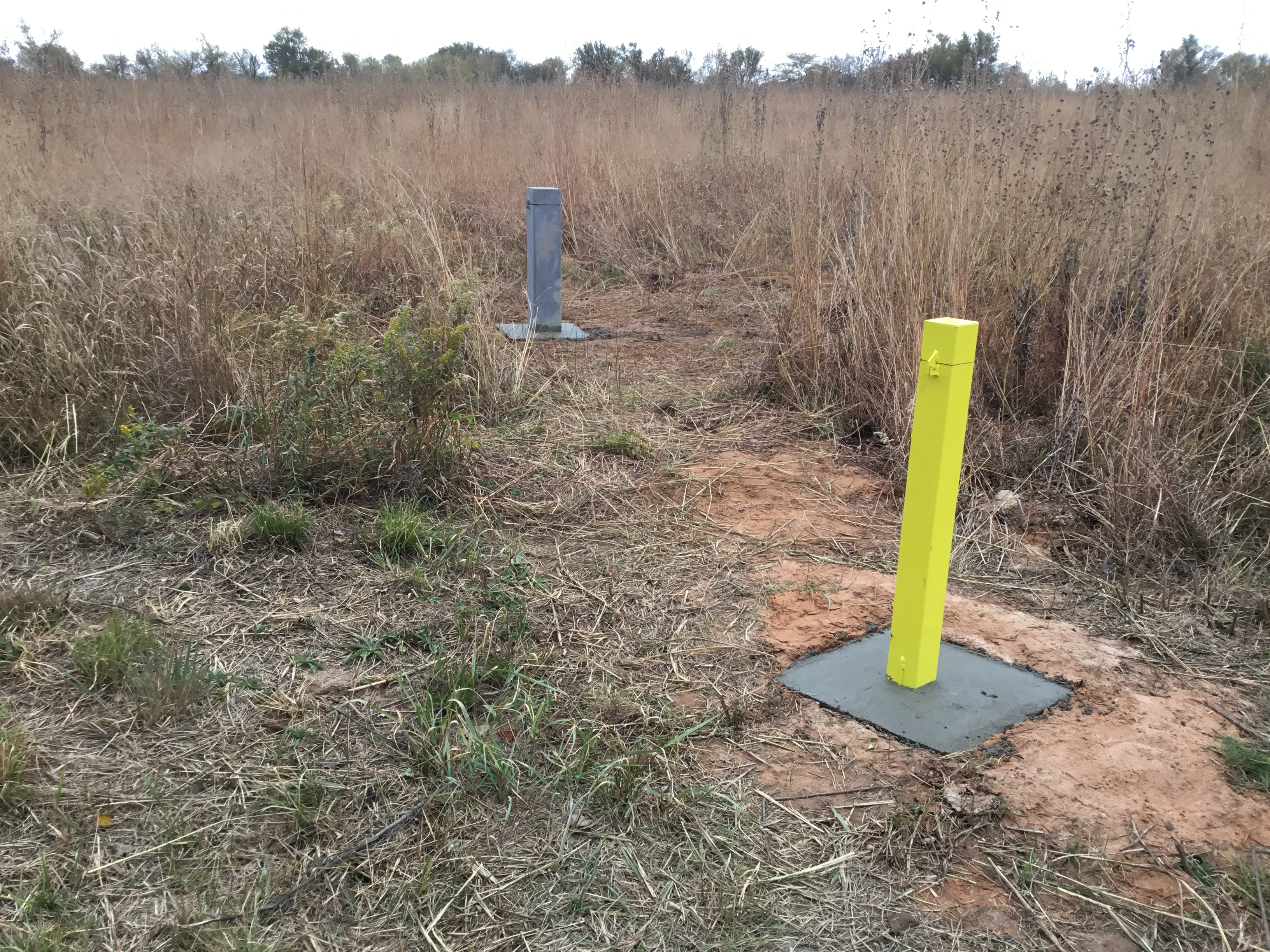
- Hydrogeologic Field Site at the Ninnescah Reserve. Groundwater wells are identified by yellow stick-up boxes, square features are part of an on-going Biology Department experiment.
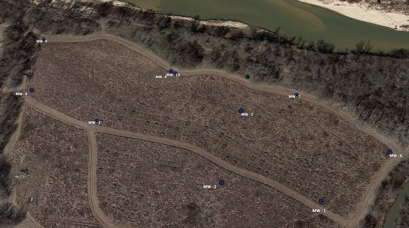
- Groundwater well location map
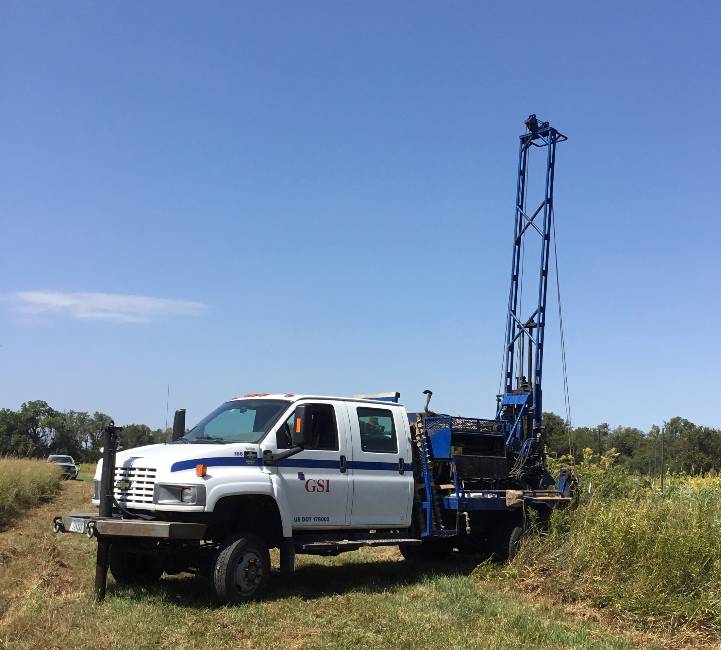
GSI Engineering completed geoprobe borings and EC characterization in 2018, and completed groundwater well installation in November 2019. This facility provides WSU students with a location to gain real world experience with activities frequently used by professional geologists such as groundwater level gauging, pump tests, slug tests, and low-flow groundwater sampling. The proxity of the wells to the Ninnescah River allows students to study the relationship between river stage and groundwater level in the alluvial aquifer. Located in one of the managed prairies at the Ninnescah Reserve, the groundwater wells also provide a research site to investigate the impacts of land managment practices (burning, mowing, etc.) on groundwater levels and groundwater chemistry. This facility is open to use by reseachers outside of WSU. Anyone interested in using this facility is encouraged to contact Dr. Swindle (andrew.swindle@wichita.edu)
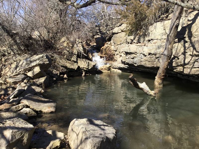
Located in the Flint Hills region of Kansas, the Youngmeyer Ranch provides a convenient location to explore concepts related to stratigraphy, structure, geomorphology, and hydrology.
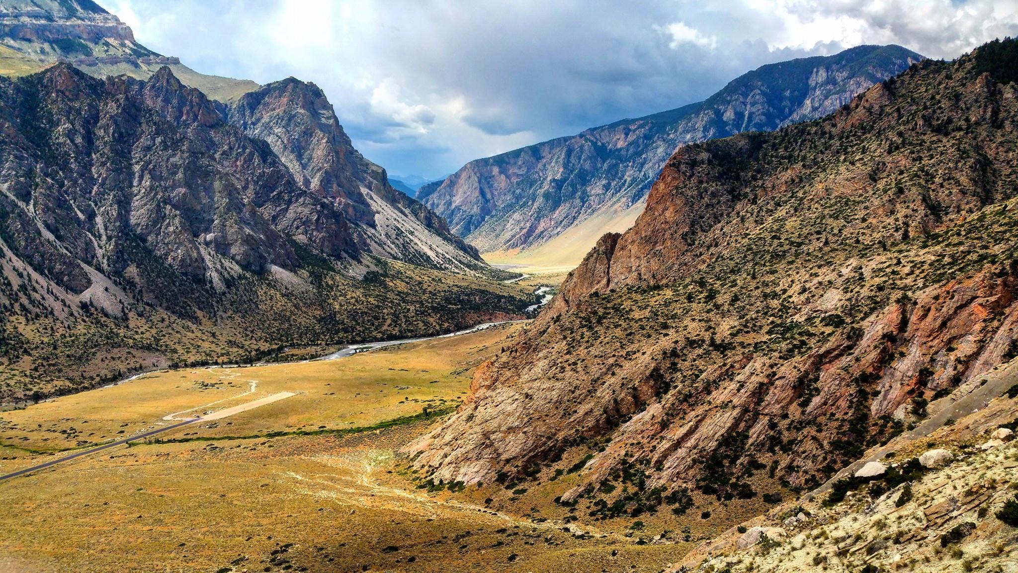
Northwest College facilities in the Bighorn Basin of Wyoming and Montana provides annual summer access to teaching and research opportunities in deep-time stratigraphy, structure, and geomorphology. More information can be found with the Sedimentary Basin Analysis and Modeling Lab and WSU Geology Field Camp.