Clinton Dick/Undergraduate Admissions
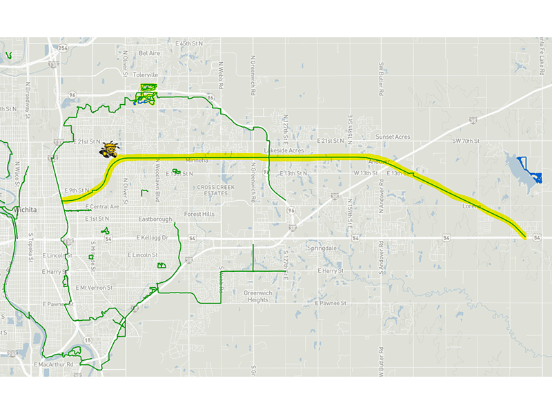
Campus has many accessible walkways. However, those looking for a path outside Wichita State may find the Redbud Trail suitable for a stroll.
A former BNSF railroad, the nearly 16 miles of re-purposed Rail-Trail is a perfect place for walking (and dog walking), jogging and biking. The best part? The trail conveniently runs directly south of Wichita State, crossing at 17th and Oliver near a well-placed parking area.
The Redbud Trail stretches from the west trailhead at North Hydraulic in Wichita, near downtown and almost directly underneath I-135, all the way east to just outside Augusta. The first several miles of the trail in Wichita are made of concrete pavement followed by gravel starting at Woodlawn heading east. It is also paved between North 159th and East 13th in Andover.
Not only is it one of Wichita’s longest trails, but Redbud also serves as an important connector to several other popular trails in the city. The Canal Hike and Bike Trail runs along the 1-135 canal route and intersects with the Redbud at its west trailhead. The Canal Trail is five miles with its south trailhead at Stafford Street and South Swan Street and its north trailhead at the very north end of McAdams Park where it runs into the McAdams Bike Path. McAdams is slightly more than five miles and connects to the K-96 Bike Path at North Oliver. As it sounds, the K-96 trail follows the highway east and west, intersecting with the Redbud before its trailhead at North 127th Street East.